


Featured

Irish Man’s “Voice Like Butter” Makes Classic Song Unforgettable
Ireland’s Got Talent was graced with an unforgettable performance when 31-year-old Steve Barry from Kerry took the stage. His rendition of “Somewhere” from West Side Story captivated both the audience and the judges. With his soaring vocals and emotional delivery, Steve transformed the classic song into a breathtaking moment. It was a performance that combined...
Jake Manning
06.17.25


Stay up to date on the latest stories on Shareably.
By signing up, I agree to the Terms and Privacy Policy

Thanks for signing up!
You're now subscribed to the latest stories.
Entertainment
Handsome Man’s Sultry Voice Earns Him “Golden Buzzer”
Jake Manning
06.16.25
Style
Wife Feels “Ugly” Until Makeover Makes Her Husband Fall In Love With Her Again
Jake Manning
01.21.25
Life
Little Boy Wakes Up From 16-Day Coma With Request Melting Internet’s Heart
Jake Manning
01.21.25
Entertainment
8 courageous dads in tutus perform comical dance that leaves crowd rolling
Jake Manning
11.30.24
Music
Man asks young boy to play Bohemian Rhapsody, so he puts on a show they’ll never forget
Jenny Brown
11.30.24
Beauty
Retired teacher goes short & all gray in makeover and looks fabulous
Jake Manning
11.30.24
More Top Stories
Life

Baby girl with Down syndrome shows off her ‘new smile’ to adoptive mom in sweet moment
The first time a baby smiles at you is a magical thing. Their toothless, chubby grins can melt even the hardest of hearts. One young girls smile turned out to be the key to her early adoption. Baby H, so named because of adoption protocols, was lounging in her new home, with her new family,...
Jenny Brown
11.30.24
Entertainment

Fans are swooning for this adorable Sheepadoodle who looks exactly like Charlie Brown’s Snoopy
When you see those iconic black ears, oval face, and black nose, it doesn’t take long to recognize that it’s Snoopy. Created by Charles Schultz, Charlie Brown’s adorable, universally-loved beagle won everyone’s hearts in all the adventures he had with the likes of his owner, Charlie Brown, as well as Lucy, Linus, Woodstock, and Peppermint...
Jake Manning
11.30.24
Entertainment

3 tiny dancers line up but boy in middle steals spotlight
Elvis Presley made the song “Hound Dog” famous, but it wasn’t written for him. Jerry Leiber and Mike Stoller gave the song to Willie Mae “Big Mama” Thornton in 1952. But it was Freddie Bell and the Bell Boys who replaced the racy words with the ridiculous, since some of the lyrics were questionable for...
Jenny Brown
11.29.24
Music

Blind teen’s audition so incredible Simon runs onstage to request another song
Putri Ariani is a gifted teenage singer from Indonesia who just about impressed everyone on America’s Got Talent. The 17-year-old is blind but that doesn’t stop her from chasing her dreams. “My biggest challenge is people look at me just as a blind person, not as a musician. But when I’m singing, I feel like,...
Jake Manning
11.29.24
Music

Elvis Presley sang his final song at a concert in 1977 and it was the perfect pick
The 18,000 people who watched Elvis Presley perform at Indianapolis’s Market Square Arena on June 26, 1977 were just a few of the lucky Elvis fans. Nobody knew this was the last. It was his final show. Elvis Presley passed away in his Graceland home in Memphis, Tennessee just shy of two months later on...
Jake Manning
11.29.24
Life

Dad leaves backyard gate open and 200 ‘intruders’ hilariously come right in
It’s not always fun if a neighbor stops by unannounced – but imagine that times 200! One family was enjoying a quiet evening at home when suddenly, a flock of 200 “intruders” decided to crash their backyard party. The Russos live in Lincoln, California. In this city, sheep are often used to clear overgrowth that...
Jake Manning
11.29.24
Life
Life
Mom leaves heartbreaking note on porch only to capture trick or treaters’ act of kindness
Jake Manning
11.04.24
Life
Kid with adorable Southern accent turns to granny and asks “I’m poor, ain’t I?”
Jake Manning
10.30.24
Life
Adorable twin babies can’t stop laughing and it’s melting hearts
Jake Manning
10.28.24
Life
Dad can’t find babysitter for court not expecting officer to take over in sweetest way
Jake Manning
10.22.24
Life
Toddler meets new baby brother and her reaction wins the internet
Jake Manning
10.22.24
Life

Big brother tries to teach little sis about manners only it takes funny turn
If you grew up with an older sibling, then you know all about the unsolicited advice they love to give. It’s almost like a rite of passage! They’ve been around longer, so naturally, they assume they’ve gathered enough wisdom to pass down to you. But whether you’re on the receiving or giving end of this...
Jake Manning
10.21.24

Great Dane can’t handle brother getting all the attention and throws funniest fit
Jake Manning
10.18.24


Recommended for you
Life

High-school senior takes his 92-year-old great-grandma to prom and they steal the show
Jake Manning
11.26.24
Life

Golden Retriever’s hilarious struggle with kitten in his bed earns 34M views
Jenny Brown
11.26.24
Music

Man sings ‘White Christmas’ with exceptionally deep voice and it’s captivated the internet
Jake Manning
11.23.24
Life

Man gets creative and builds a giant multi-room igloo family can’t get enough of
Jake Manning
11.23.24
Music

Lights cut off at supermarket turning into incredible Christmas performance no one saw coming
Jake Manning
11.22.24
Life

Santa takes giant shelter dog onto lap to tell him he’s getting a forever home for Christmas
Jake Manning
11.22.24
Music

First-grader sings moving version of ‘Hallelujah’ leading to 14M views
Jake Manning
11.21.24
Music

2 teen boys sing like angels but when 131 more join it leaves crowd emotional
Jake Manning
11.20.24
Entertainment
Music
Michael Bublé performs soulful cover of Bee Gees song as touching tribute to Barry Gibb
Jake Manning
10.31.24
Music
Simon interrupts 11-yr-old singing Aretha Franklin but her comeback brings down the house
Jake Manning
10.31.24
Entertainment
Couple has crowd glued with silky dance then rock song takes it to a whole new level
Jake Manning
10.30.24
Music
Adorable kid sings Elvis tune forcing every judge to slam their button
Jake Manning
10.29.24
Entertainment
9 beautiful cowgirls line up and perform dance that rakes in 3M views
Jake Manning
10.29.24


Recommended for you
Entertainment

Man leads group in rockin’ Queen dance that’s left millions smiling
Jake Manning
11.19.24
Music

3-year-old delivers the most adorable ‘Hallelujah’ that stops people in the street
Jake Manning
11.18.24
Music

Celtic Woman’s heavenly cover of ‘You Raise Me Up’ brings crowd to their feet
Jake Manning
11.17.24
Trending

Funny dog spots Dad’s leaf pile and there’s no holding her back
Jake Manning
11.15.24
Music

Tough soldiers melt hearts when they start singing ‘My Girl’
Jake Manning
11.15.24
Life

Dad’s hilarious move to stop teens from texting at dinner table has millions rolling
Jake Manning
11.15.24
Music

Siblings blend voices and bring ‘Unchained Melody’ to beautiful new heights
Jake Manning
11.14.24
Entertainment

Teens light up floor with classic dance moves and score 1st place
Jake Manning
11.13.24
Trending
Trending
Hundreds show up for act of kindness after kids’ lemonade money is stolen
Jake Manning
10.29.24
Trending
Family takes in talkative parrot and her words quickly have them rolling
Jake Manning
10.25.24
Trending
Nervous rescue lion gets 1st taste of freedom and his reaction is heart-melting
Jake Manning
10.23.24
Trending
Farmers shake up the barn with ‘Farmer Rock Anthem’ leaving 2.7M smiling
Jake Manning
08.07.24
Trending
Man’s costume change so unexpectedly hilarious Simon says “That was genius!”
Jake Manning
08.07.24
Trending
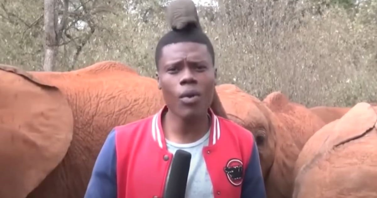
Reporter can’t keep straight face as adorable baby elephant steals the show
Nearly 90% of African elephants have disappeared in the past century, primarily due to the extensive ivory trade, according to WWF. Currently, only about 415,000 wild elephants remain. These magnificent creatures face another significant threat: the deteriorating state of our environment. With this alarming backdrop, many people are striving to raise awareness about the need...
Jake Manning
08.02.24

Wild dolphin gets diver’s attention with gift he’ll never forget
Jake Manning
07.29.24


Recommended for you
Life

Grandma’s working at McDonald’s when stranger approaches with life-altering gift
Jake Manning
11.13.24
Life

Dog waltzes into supermarket and hilariously steals his own Christmas present
Jake Manning
11.12.24
Entertainment

Man brings tiny gold almanac from 1840 to be appraised and it’s a real treasure
Jake Manning
11.12.24
Beauty

Grieving mom ‘lets herself go’ only to be renewed with most gorgeous makeover
Jake Manning
11.12.24
Entertainment

Dance team brings ‘Sweet Caroline’ to life with their incredible performance
Jake Manning
11.11.24
Music

Parrot perks up when man sings ‘Bird is the Word’ and hilariously steals his thunder
Jake Manning
11.08.24
Entertainment

Mom and son’s wedding dance turns into slick performance for the books
Jake Manning
11.08.24
Life

Boy’s adorably funny response to why God created grandmothers is melting hearts
Jake Manning
11.08.24
More from Shareably
Music

Music
Jennifer Nettles performs one of Neil Diamond’s greatest hits making him tear up with her version
Jake Manning
11.28.24
Entertainment

Entertainment
High school student perform enchanting waltz to Ed Sheeran’s “Perfect”
Jake Manning
11.27.24
Life

Life
Woman wakes to find an unknown dog on her patio furniture that refuses to leave
Jenny Brown
11.27.24
Life

Life
Police officer stops to have cute conversation with adorable baby owl
Jenny Brown
11.27.24
TV & Movies

TV & Movies
Hilarious Carol Burnett Show bloopers prove the entire cast were comedic geniuses
Jenny Brown
11.26.24
Music

Music
Cher gets emotional hearing Adam Lambert’s moving version of her famous song
Jake Manning
11.26.24