


With rapid technological advancement, one might think maps are becoming obsolete. However, they thrive in the digital age in more sophisticated forms, showing real-time population density or future Earth projections.
The internet is full of fascinating maps that offer fresh insights. We have curated some of the best to expand your perspective. Let’s begin with:
Occupied Bald Eagle Nests in Wisconsin: 1974 vs. 2019
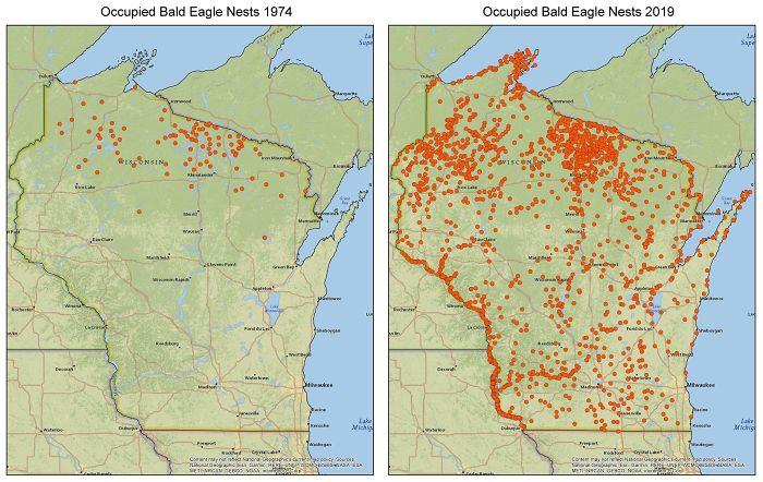
The growth of the bald eagle population is attributed to the Clean Water Act.
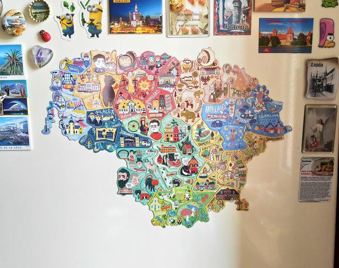
Lovely looking souvenirs
To boost local tourism, Lithuania has created a map featuring magnets that can only be found in their corresponding cities.
Source:
reddit
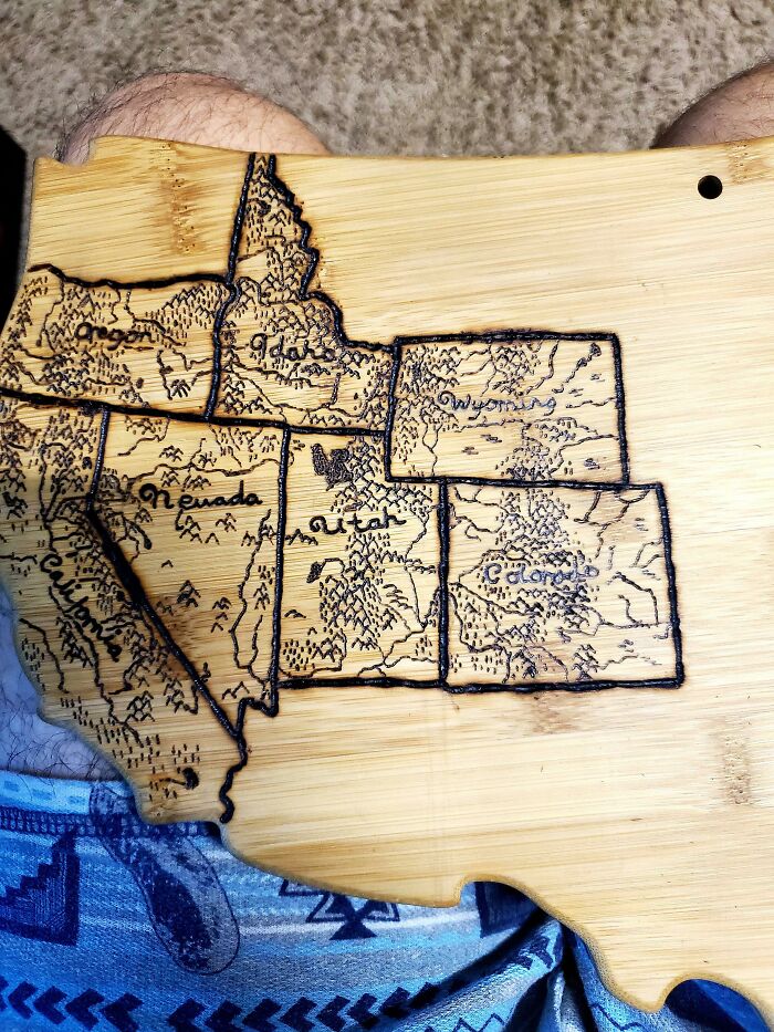
Wedding gift for the wife
Her husband shared, “We get married next Sunday. I used a woodburning kit to burn a map of all the states we have visited as a couple. We both love to travel and backpack do I want to to keep adding to it as we get older.”
Source:
reddit
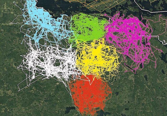
They’re smart animals
A GPS tracking image of multiple wolves in six different packs around Voyageurs National Park illustrates how the wolf packs actively avoid each other’s ranges.
Source:
reddit
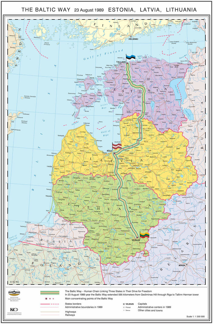
The Baltic Way
On August 23, 1989, two million people joined hands to form a human chain spanning 675.5 km across the three Baltic States. The protest was against the Soviet occupation and supported the independence movements of the three Baltic States.
Source:
reddit
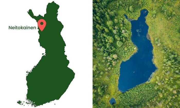
Finland in Finland
Lake Pielinen in eastern Finland resembles the shape of Finland itself. It spans approximately 894 square kilometers, making it one of the country’s largest lakes. The lake is a popular destination for outdoor activities and is located near Koli National Park, offering stunning views and natural beauty.
Source:
reddit
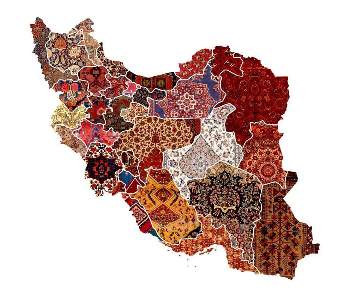
Iran’s Regional Rug Patterns
Call a buddy and make your way over there, because everyone knows they make nice rugs.
Source:
reddit
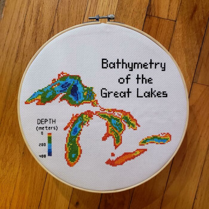
Stitching skills
“Hello! I cross stitch earth science maps and have been told they belong here. Great Lakes Bathymetry is my favorite so far.” – Reddit
Source:
reddit
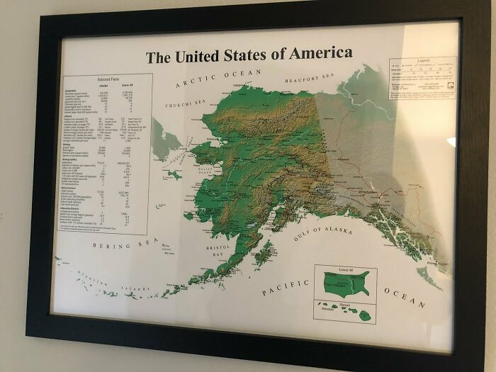
Alaskan perspective
Alaska, the largest U.S. state, spans approximately 663,300 square miles, making it more than twice the size of Texas. It has the longest coastline in the U.S. and contains several vast national parks, including Wrangell-St. Elias, the largest in the nation.
Source:
reddit
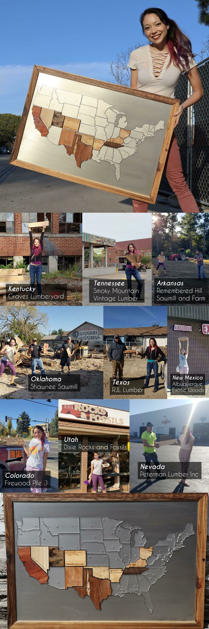
It’s the wood
Now here’s a unique idea she’s got going. Not everyone is into wood, are they?
Source:
reddit
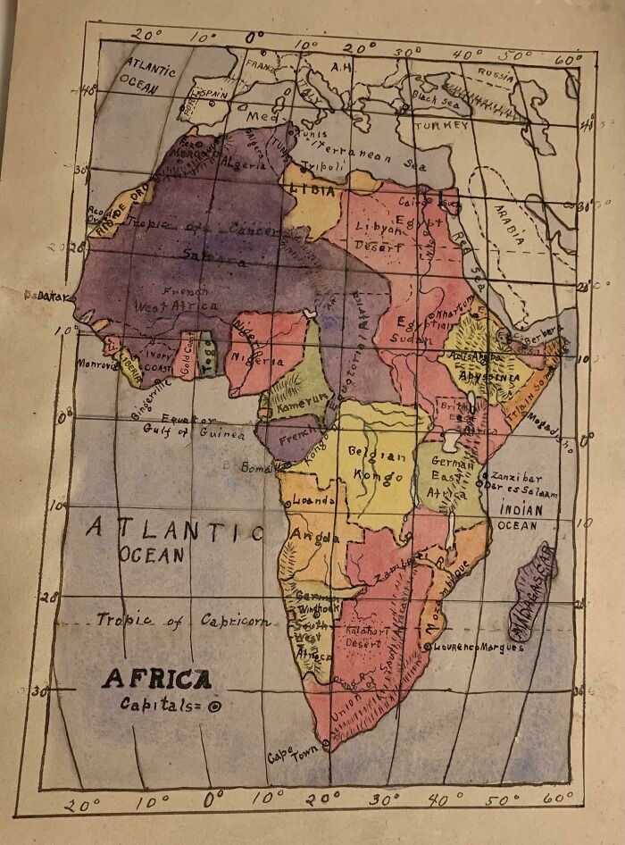
Grandpa can draw
Someone’s great grandfather drew this, and wow is it impressive.
Source:
reddit
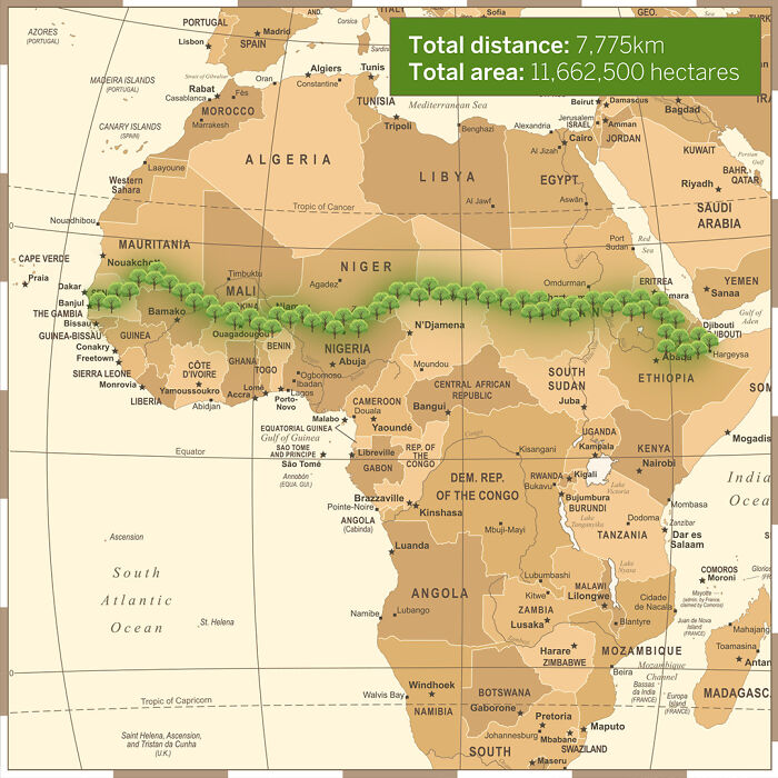
To combat the threat of desertification in the Sahel, the region just south of the Sahara
The African Union is spearheading an initiative to plant the Great Green Wall, a 7,775 km (4,830 mi) belt of trees stretching across the entire width of North Africa.
Source:
reddit
Centering the Earth on Great Britain is arbitrary, so here’s a map centered on New Zealand.
Centering maps on specific locations is often arbitrary and can influence our perspective of the world. While many maps traditionally center on regions like Europe or North America, this can skew our understanding of global geography. By centering a map on New Zealand, we can gain a different perspective, highlighting the importance of different regions and challenging the Eurocentric view often presented in maps. This shift allows us to appreciate the significance of the Pacific region and provides a more balanced representation of the world.
Source:
reddit
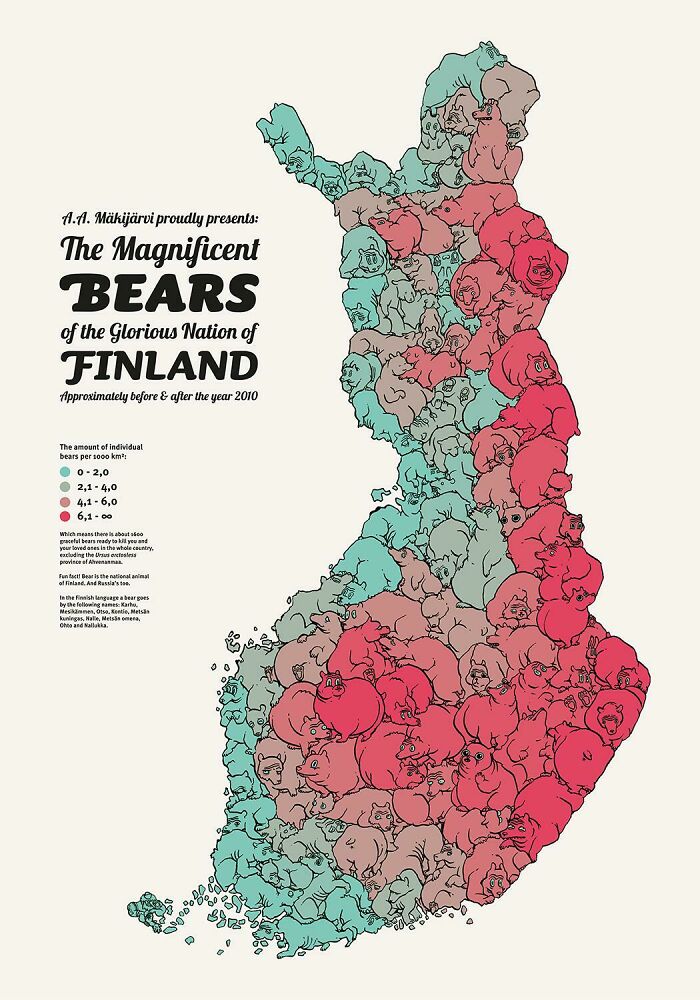
Finland’s bear population
Now this is a bear-y interesting way of illustrating a map.
Source:
reddit
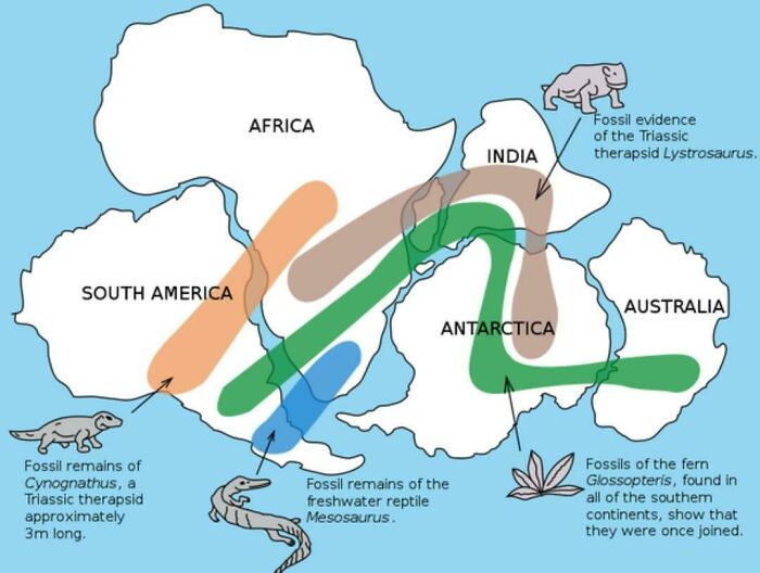
Pangaea
The existence of Pangaea is supported by evidence of similar fossils found across continents.
Source:
reddit
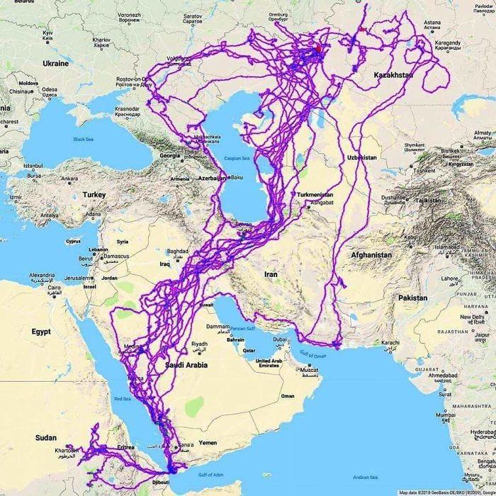
Tracking an eagle over a 20-year period.
That’s a lot of flight miles, and a lot of energy used up.
Source:
reddit
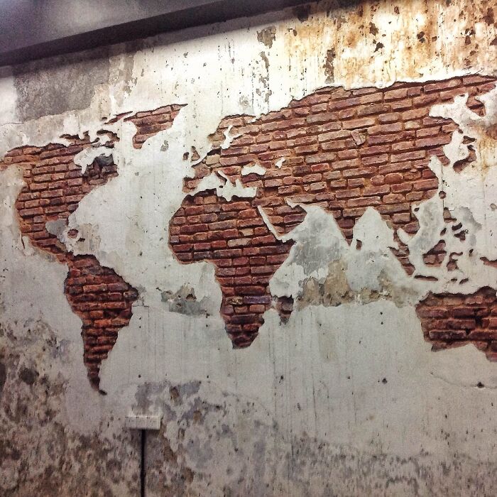
Mural of the world map
Just another take on our magnificent planet and the lands we occupy.
Source:
reddit
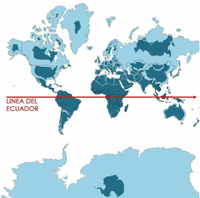
Blue light
Light blue represents the map as we know it, while dark blue shows the actual size of each country.
Source:
reddit
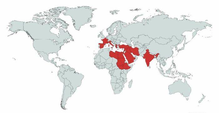
Countries mentioned or referenced in the Bible
So much happened in such a small space but its impact on the world is profound.
Source:
reddit
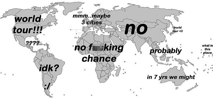
When bands announce a world tour
Just buy tickets online and fly to said place, right?
Source:
reddit
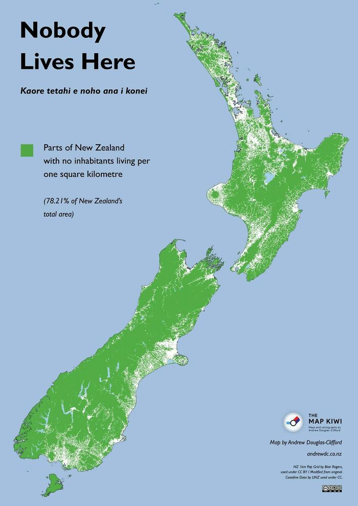
Middle Earth
No one resides in the green areas of New Zealand, where the population density is 0 people per square kilometer, comprising about 78% of the country’s land.
Source:
reddit
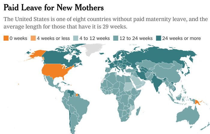
Take note, ladies
Countries that offer paid maternity leave and the duration provided for expecting mothers.
Source:
reddit
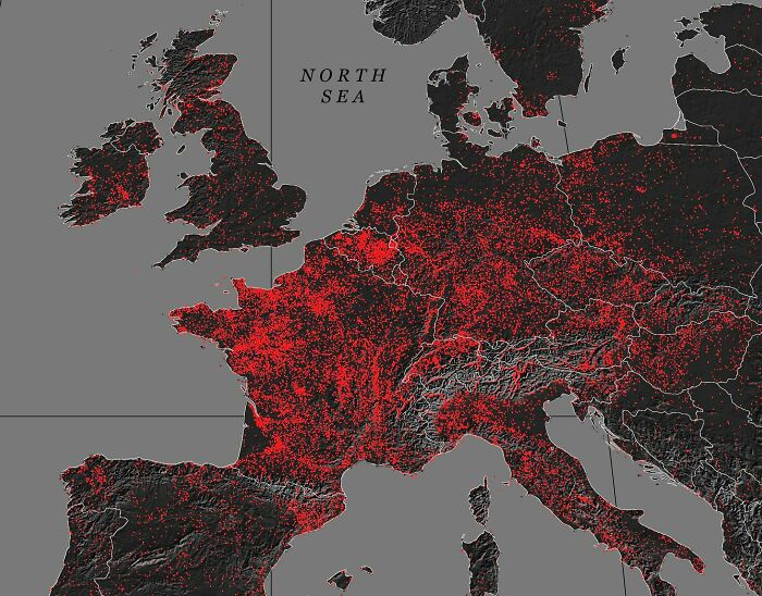
Castles in Europe
There’s a lot of them alright. Wouldn’t it be a dream to own one?
Source:
reddit
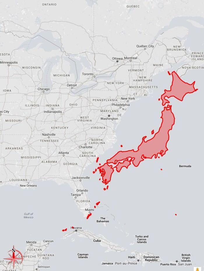
The size of Japan
Right beside the US East Coast for scale, because sushi per chopsticks is difficult to compare against bald eagles per cheeseburger.
Source:
reddit
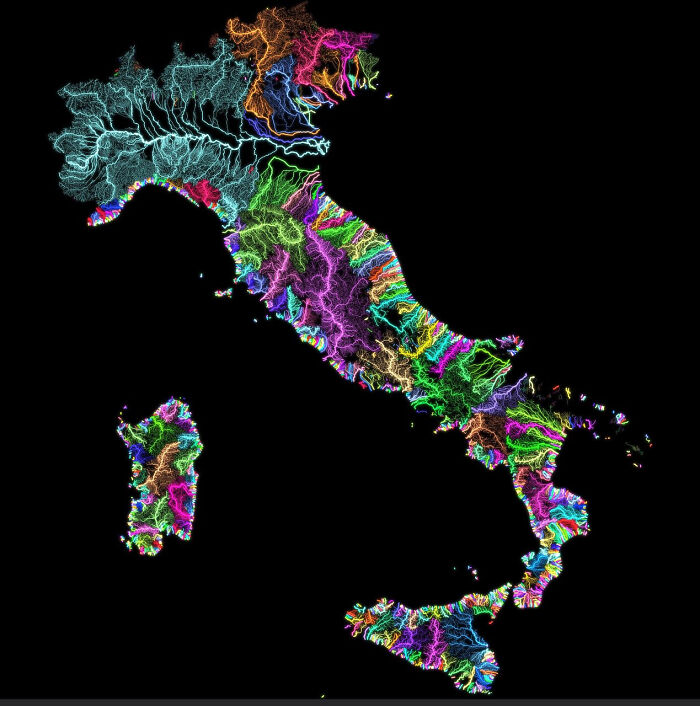
Italian rivers
And of course, since it’s Italy, the map has to be very pretty.
Source:
reddit
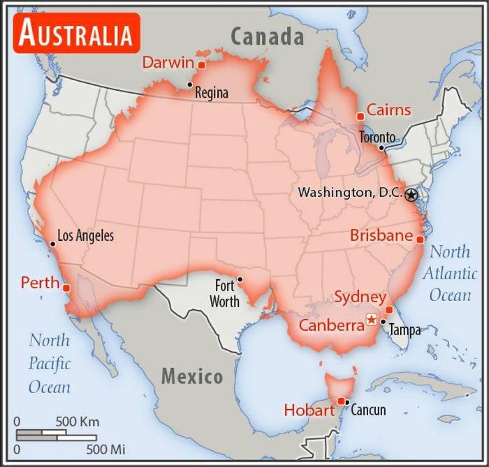
A comparison of the sizes of Australia and the United States
It’s in no way a small country. Those freaky animals don’t help matters either.
Source:
reddit
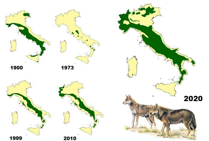
The distribution of wolves in Italy from 1900 to 2020
The green are all the wolves in case you were wondering.
Source:
reddit
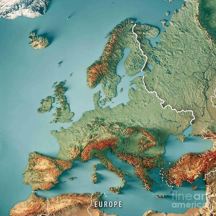
3D-rendered topographic map of Europe.
Maps like these give insight as to the terrain you can expect should you decide to travel.
Source:
reddit
A talented pool
Following Tokyo 2020, this map remains consistent. All male water polo gold medalists since 2000 were born within this circle.
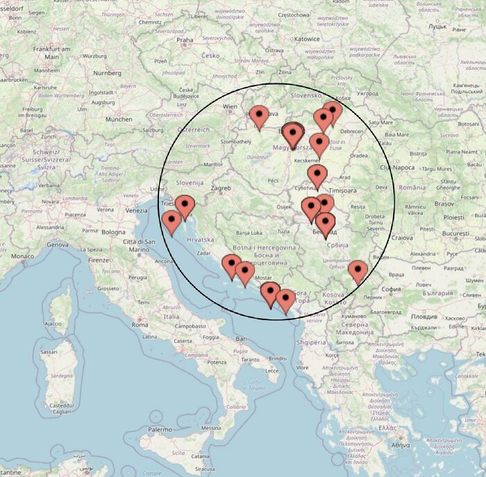
Source:
reddit
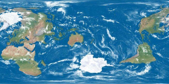
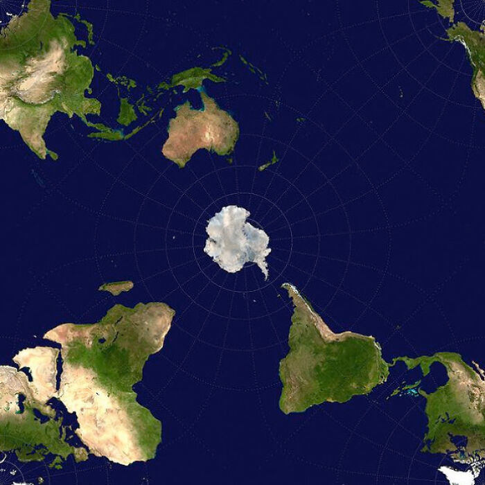
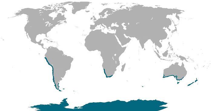
World map centered on Antarctica
Antarctica is Earth’s southernmost continent, known for its extreme cold and vast ice sheets. It’s a hub for scientific research, home to unique wildlife like penguins and seals. Governed by the Antarctic Treaty System, it prohibits military activity and mining, promoting research and environmental protection.
Source:
reddit
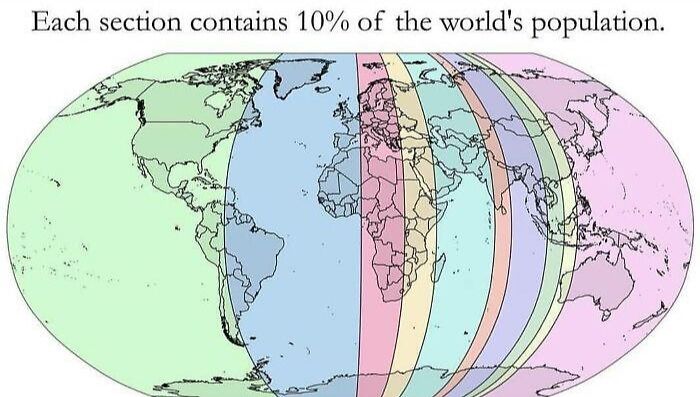
The way we’re making up the planet
For those who are unsure, the denser the population, the narrower the sliver.
Source:
reddit
The longest train journey in the world
IF this is on your bucket list, better make sure you’ve got everything packed.
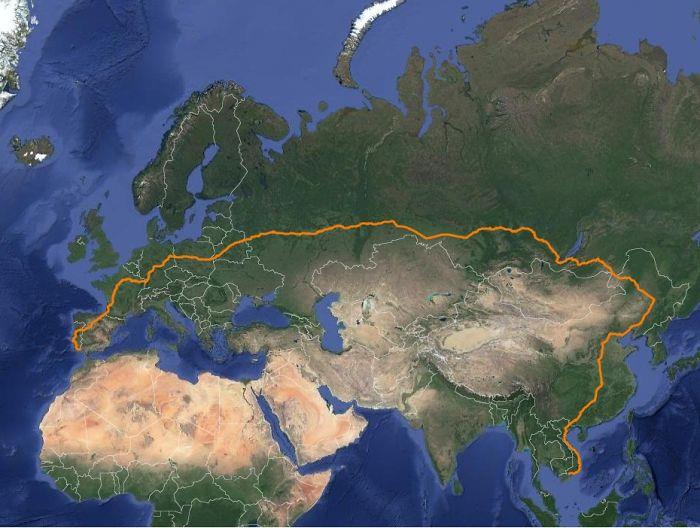
Source:
reddit
Natural habitats of penguins around the world
Shame you can’t keep one as a pet though. But imagine if you did have a penguin at home.
Source:
reddit
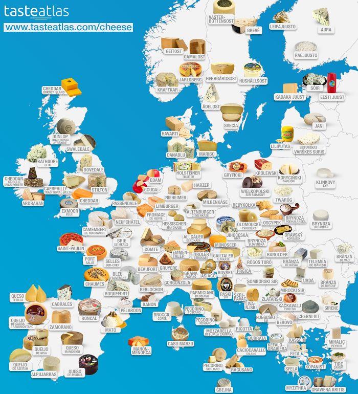
Europe’s cheeses
Now here’s one to show family and fiends before you go off buying cheeses.
Source:
reddit
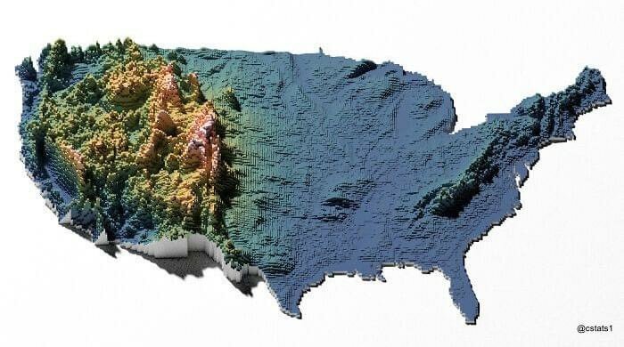
US elevation map
Not so easy planning a drive across the country, is it?
Source:
reddit
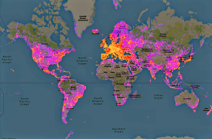
Map showcasing the most photographed places worldwide
Pretty much the places we expected. Go hit up Greenland though.
Source:
reddit
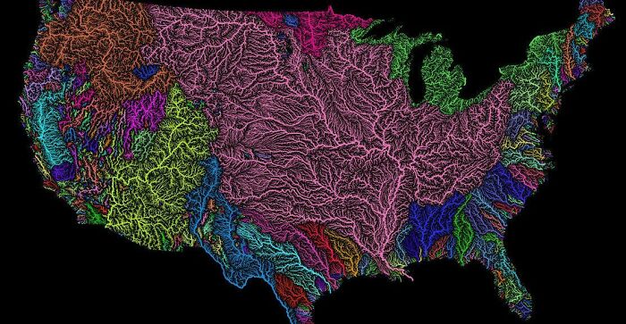
US Watersheds
There are thousands of watersheds in the United States, varying in size from small creeks and streams to large river basins such as the Mississippi River watershed.
Source:
reddit
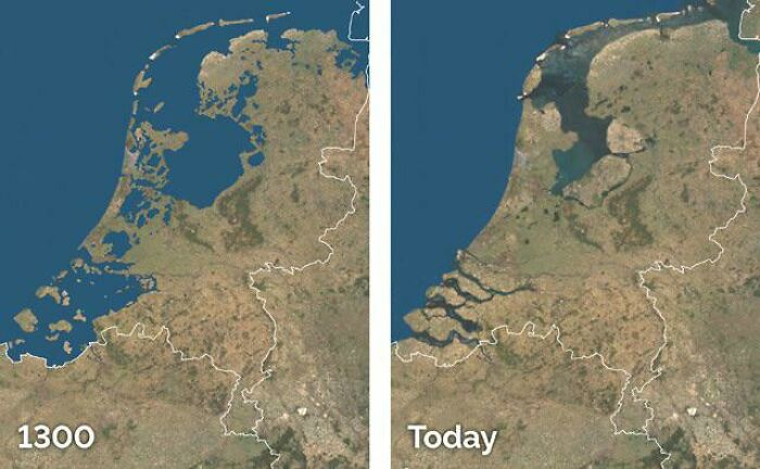
Land reclamation in the Netherlands
Land reclamation offers various benefits, including the expansion of usable land, flood control, protection of coastal areas, increased agricultural productivity, creation of new habitats, economic growth, infrastructure development, and environmental restoration.
Source:
reddit
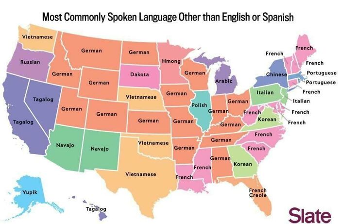
The most commonly spoken language in the US after English and Spanish
German is the third most commonly spoken language in the US because of historical immigration patterns. Large numbers of Germans immigrated to the United States during the 19th century, particularly in the Midwest, where German-speaking communities became established. This historical presence has resulted in German maintaining its position as one of the most spoken languages in the US after English and Spanish.
Source:
reddit
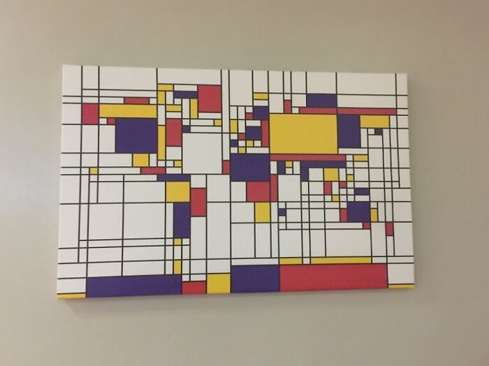
Abstract world map
Here’s an interesting piece to hang up in your living room.
Source:
reddit
Please SHARE this with your friends and family.
